


Water: Lake Washington - Seattle Leg 37, King County, Washington
About
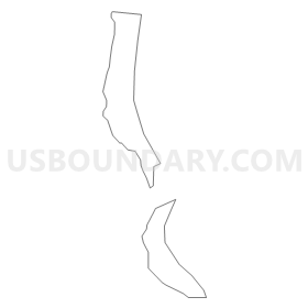
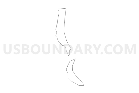
Outline
Summary
| Unique Area Identifier | 685496 |
| Name | Water: Lake Washington - Seattle Leg 37 |
| County | King County |
| State | Washington |
| Area (square miles) | 5.22 |
| Land Area (square miles) | 0.00 |
| Water Area (square miles) | 5.22 |
| % of Land Area | 0.00 |
| % of Water Area | 100.00 |
| Latitude of the Internal Point | 47.56958110 |
| Longtitude of the Internal Point | -122.26383580 |
Maps


Graphs
Select a template below for downloading or customizing gragh for Water: Lake Washington - Seattle Leg 37, King County, Washington


Neighbors
Neighoring Voting District (by Name) Neighboring Voting District on the Map
- Bryn Mawr Voting District, King County, WA
- M-I 41-0755 Voting District, King County, WA
- M-I 41-0758 Voting District, King County, WA
- M-I 41-0761 Voting District, King County, WA
- M-I 41-0769 Voting District, King County, WA
- M-I 41-0780 Voting District, King County, WA
- M-I 41-0781 Voting District, King County, WA
- M-I 41-0789 Voting District, King County, WA
- M-I 41-0792 Voting District, King County, WA
- M-I 41-2445 Voting District, King County, WA
- MED 48-0749 Voting District, King County, WA
- MED 48-0752 Voting District, King County, WA
- SEA 37-1553 Voting District, King County, WA
- SEA 37-1555 Voting District, King County, WA
- SEA 37-1557 Voting District, King County, WA
- SEA 37-1564 Voting District, King County, WA
- SEA 37-1565 Voting District, King County, WA
- SEA 37-1566 Voting District, King County, WA
- SEA 37-1587 Voting District, King County, WA
- SEA 37-1588 Voting District, King County, WA
- SEA 37-1589 Voting District, King County, WA
- SEA 37-1590 Voting District, King County, WA
- SEA 37-1612 Voting District, King County, WA
- SEA 37-1613 Voting District, King County, WA
- SEA 37-1631 Voting District, King County, WA
- SEA 37-1632 Voting District, King County, WA
- SEA 37-1647 Voting District, King County, WA
- SEA 37-1650 Voting District, King County, WA
- SEA 37-1872 Voting District, King County, WA
- SEA 37-1890 Voting District, King County, WA
- SEA 37-1903 Voting District, King County, WA
- SEA 37-1911 Voting District, King County, WA
- SEA 37-1915 Voting District, King County, WA
- SEA 37-1916 Voting District, King County, WA
- SEA 37-1917 Voting District, King County, WA
- SEA 37-1918 Voting District, King County, WA
- SEA 37-1919 Voting District, King County, WA
- SEA 37-1920 Voting District, King County, WA
- SEA 37-1921 Voting District, King County, WA
- SEA 37-1936 Voting District, King County, WA
- SEA 37-1937 Voting District, King County, WA
- SEA 43-1819 Voting District, King County, WA
- Water: Lake Washington - Seattle Leg 43, King County, WA
- Water: Lake Washington Leg 37, King County, WA
Top 10 Neighboring County Subdivision (by Population) Neighboring County Subdivision on the Map
Top 10 Neighboring Place (by Population) Neighboring Place on the Map
- Seattle city, WA (608,660)
- Mercer Island city, WA (22,699)
- Bryn Mawr-Skyway CDP, WA (15,645)
- Medina city, WA (2,969)
Top 10 Neighboring Unified School District (by Population) Neighboring Unified School District on the Map
- Seattle School District, WA (609,471)
- Bellevue School District, WA (124,003)
- Renton School District, WA (115,511)
- Mercer Island School District, WA (22,699)
Top 10 Neighboring State Legislative District Lower Chamber (by Population) Neighboring State Legislative District Lower Chamber on the Map
- State House District 41, WA (142,722)
- State House District 43, WA (133,976)
- State House District 48, WA (130,423)
- State House District 37, WA (127,546)
Top 10 Neighboring State Legislative District Upper Chamber (by Population) Neighboring State Legislative District Upper Chamber on the Map
- State Senate District 41, WA (142,722)
- State Senate District 43, WA (133,976)
- State Senate District 48, WA (130,423)
- State Senate District 37, WA (127,546)
Top 10 Neighboring 111th Congressional District (by Population) Neighboring 111th Congressional District on the Map
Top 10 Neighboring Census Tract (by Population) Neighboring Census Tract on the Map
- Census Tract 118, King County, WA (7,383)
- Census Tract 243, King County, WA (7,255)
- Census Tract 119, King County, WA (7,108)
- Census Tract 101, King County, WA (6,553)
- Census Tract 95, King County, WA (5,906)
- Census Tract 78, King County, WA (5,145)
- Census Tract 63, King County, WA (4,962)
- Census Tract 102, King County, WA (4,835)
- Census Tract 89, King County, WA (4,829)
- Census Tract 111.02, King County, WA (4,419)
Top 10 Neighboring 5-Digit ZIP Code Tabulation Area (by Population) Neighboring 5-Digit ZIP Code Tabulation Area on the Map
- 98118, WA (42,731)
- 98122, WA (31,454)
- 98144, WA (26,881)
- 98178, WA (24,092)
- 98040, WA (22,699)
- 98112, WA (21,077)
- 98039, WA (2,971)